


A Powerhouse of Global Satellite Infrastructure: Norway?
Timothy Stryker was making his second visit to Svalbard, a Norwegian island chain nudged up against the North Pole, but the yield signs still caught his attention: They directed drivers to defer not to other cars but to polar bears. Stryker didn’t encounter such hazards in his day-to-day work in Washington, D.C. Nor did he normally encounter the austere landscape now surrounding him — fjords, ice, lunar-like rock piles, snow-studded mountains bearing down on the sea.

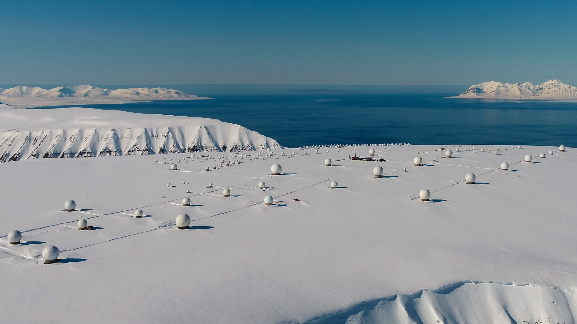
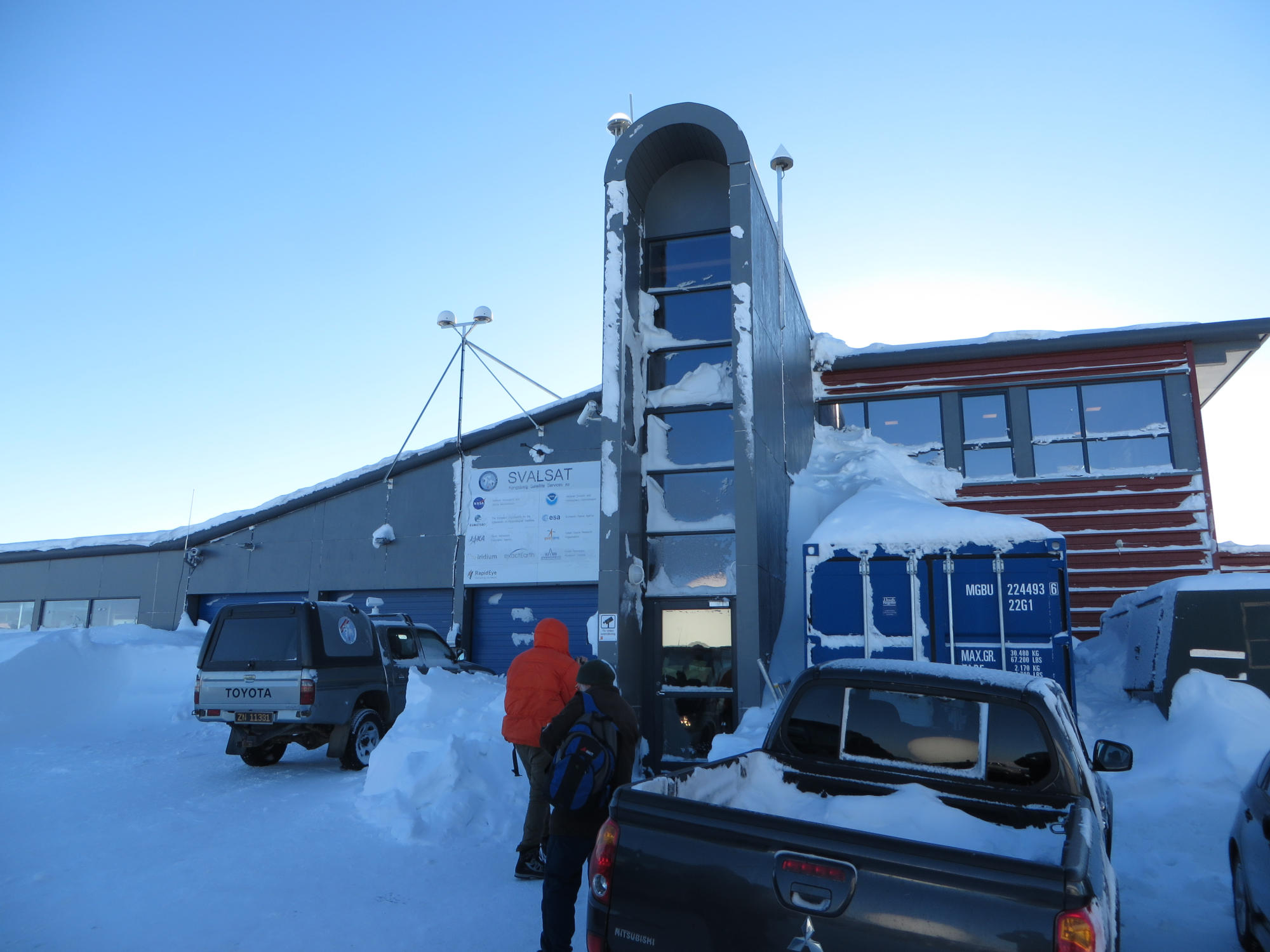
Stryker, the chief of outreach and collaboration for the United States Geological Survey’s national land imaging program, had flown to one of the globe’s northernmost settlements to see the ground station where where data from USGS satellites lands on Earth: a herd of more than 150 antennas together called SvalSat.
Norway may not be the first country that comes to mind when thinking of the space industry. But it has quietly supported satellites almost since satellites were invented and has become a ground-station powerhouse. SvalSat, for instance, boasts more antennas than any other commercial station on Earth.
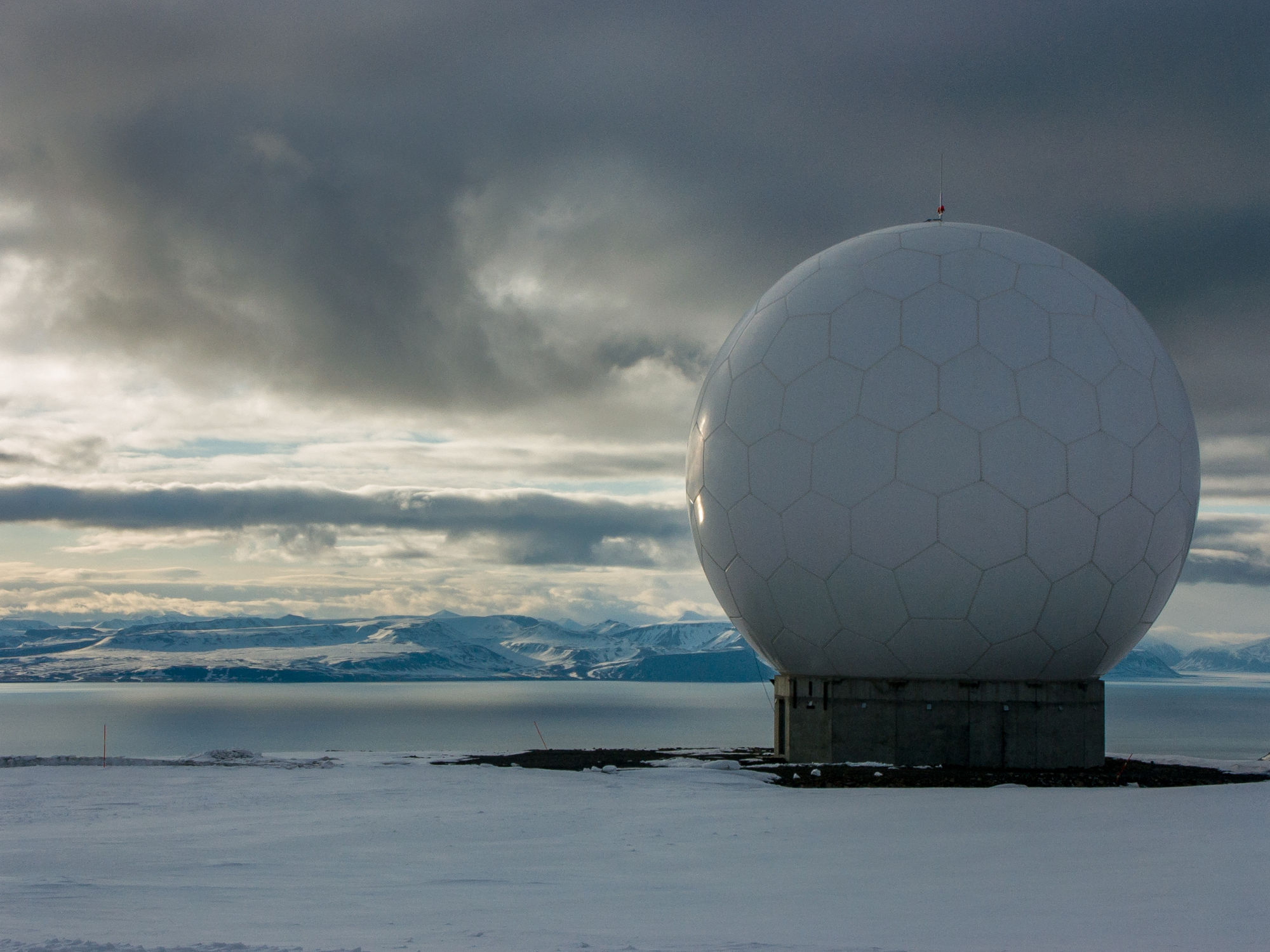
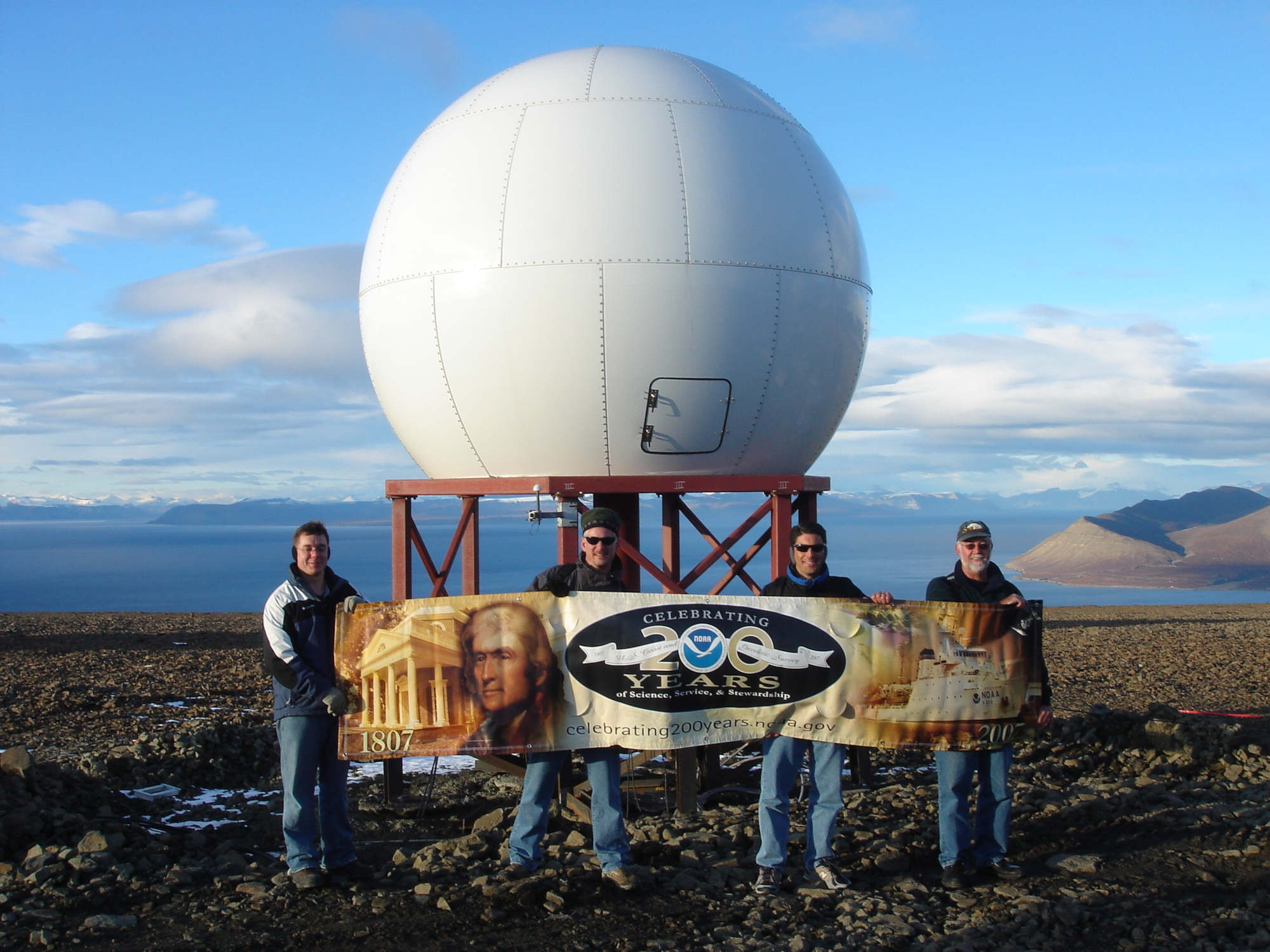
Atop the Platåberget plateau, the antennas are regularly spaced and ensconced in radomes — spherical coverings that protect them from the inhospitable environment that attacks their technology just as forthrightly as a polar bear might. Stryker likens SvalSat to a giant’s putting green; the satellites appear like colossal golf balls resting atop a rocky, and often snowy, surface.
Stryker and his colleague Ryan Brown were on the island to attend an international gathering focused on ground station operations at SvalSat. SvalSat’s users span the globe and represent myriad time zones, languages, and national agencies; gathering to talk about the nitty-gritty of satellite operations helps smooth the station’s operations. “There’s really no substitute for regular in-person interactions,” said Stryker.
Polar ground stations like this one are the only spots where satellites in certain orbits can downlink their data and receive commands on every trip around Earth. U.S. science, weather forecasting, and defense sectors all — through the happenstance of geography and history — rely on satellite infrastructure located in Norway. That includes agencies like NASA, the National Oceanic & Atmospheric Administration, and the USGS, which download climatic, geological, atmospheric, and other information to Svalbard so they can monitor and predict the state of Earth and beyond. SvalSat, because of a treaty governing relations on Svalbard, doesn’t work directly with military satellites. But other places in northern Norway do — and there, similar but smaller stations exist, chattering with spacecraft that do military communications or missile warning.
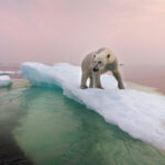
But there’s just one problem: Norway is in the middle of some hot geopolitical dynamics. For one, it shares a small land border with Russia, and tensions between the two countries have markedly increased since the Russian invasion of Ukraine. Surveillance and espionage are also on the rise. Meanwhile, melting Arctic ice makes the polar region more accessible for resource extraction, in turn making it vulnerable to territorial disputes.
Norwegian and NATO officials are worried about conflict. And the satellite sector is mindful about how those icy relations might affect some of the world’s most important data.
Work like that of the USGS, which involves peering down at Earth to get the big picture on its conditions, requires international effort. “It’s not limited to national boundaries,” Stryker said. “It’s really a global activity.”
Without ground stations like Svalbard’s, satellites are just “space junk,” said Rolf Skatteboe, CEO and president of Kongsberg Satellite Services, or KSAT, the company that runs SvalSat and is one of the world’s largest purveyors of satellite ground stations. Such stations allow operators to send commands to satellites, fix problems with their operations, and download data for further analysis.
Ground-station work in Norway began in the early 1960s, less than a decade after the world’s first satellite launched. Soon, there were initial stations on Svalbard and in Tromsø, a Norwegian city south of Svalbard, across the Norwegian and Barents Seas.
The far-northern locations were ideal for connecting with satellites that orbit from pole to pole. Ground stations there could communicate with the satellites every time they neared the North Pole to complete a planetary lap. And the relatively mild weather — by Arctic standards — made upkeep simpler than it would have been in other polar locations, like Greenland or Alaska, or even the Antarctic. (Ground stations now also exist in those locations, but Norway’s infrastructure remains significant.)
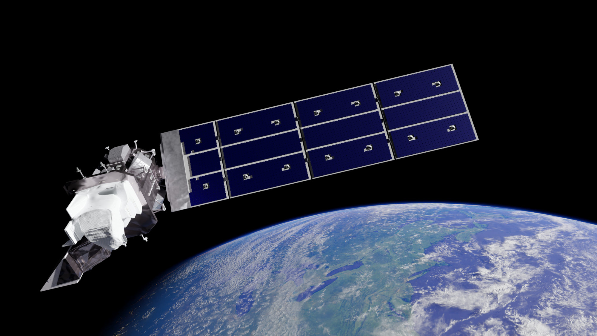
Those features, and Norway’s ground-floor expertise in ground stations, led to a big deal with NASA in the 1990s: The space agency was working on a program called “Mission to Planet Earth,” to use satellites to learn more about the world. As part of that, NASA was planning to launch Landsat 7, the seventh in a series of imaging satellites to help scientists track how land and sea look over time. Since its inception in 1972, the Landsat program has produced a rich archive of the planet’s aging surface, showing, for instance, how fisheries are faring, where wildfires chew a mountain, and when glaciers shrink.
But to get any of that archive down from space and into computers, where scientists could make sense of it, NASA — which runs Landsat with USGS — needed ground stations. And for its Earth-observation ambitions, the agency knew it needed more coverage than its own Alaska-based station could provide. So, the Norwegian Space Agency suggested they invest in Svalbard. And around 1996, NASA shipped an antenna, equipment, and a trailer-office to the Arctic archipelago.
Norwegian Space Agency employees shortly transferred from Tromsø to Svalbard, working out of NASA’s trailer to prepare the ground station. It wasn’t entirely snowproof, and it had A/C — but no heater. “They felt they were polar explorers for a while,” said Skatteboe.
In 1999, Landsat 7 made it to space and flew over the Svalbard antenna. “They serviced our first pass,” said Brown, who is today’s Landsat ground network manager.
With this initial collaboration, Svalbard was on its way to becoming “the world’s greatest, largest, biggest, nicest, coolest ground station,” as Skatteboe described it. Norway soon built its own antennas and sold ground capabilities as a service, allowing NASA to focus on exploring space.
Without ground stations like Svalbard’s, satellites are just “space junk.”
While data initially had to be shipped out on physical tape, the island was linked to mainland Norway via an undersea data cable in the early 2000s — fiber that, along with a second cable, now transfers satellite info to the continent and provides internet to the island chain. In 2002, the Norwegian Space Agency split KSAT off as a separate entity — a commercial company half-owned by the state corporation Space Norway and half-owned by the commercial Kongsberg Defence and Aerospace, completely dedicated to satellite ground stations.
Antennas on Svalbard have been servicing Landsat passes since those early days, downlinking data from those and other NASA missions for a quarter-century. “There’s a tremendous amount of science data that we pull down through there, and that informs us of what’s going on in the Earth,” said Kevin Coggins, deputy associate administrator for NASA’s Space Communications and Navigation Program.
Norway’s sustained interest in ground stations wasn’t just about helping NASA: The country had its own desires. It was fortuitous that NASA, which Skatteboe called a “partner in crime,” wanted infrastructure that would also benefit Norway. “It’s needed to monitor — not necessarily control, but to monitor — Norwegian areas of interest,” he said.
Those areas of interest include the waters around Norway, which the country wants to watch for pollution, oil spills, foreign ships, ice movement, and suspicious activity. For instance, officials track Russia’s so-called shadow fleet, which ships sanctioned goods internationally using ownership records that obscure its origins. These officials are concerned, in part, that the ships may damage undersea infrastructure — like the data cables crisscrossing the ocean floor; last December, Finnish authorities accused the fleet of severing a cable in the Baltic Sea.
“These days,” said Skatteboe, “it isn’t a secret that the geopolitical situation asks for a close monitoring of the waters.”
In recent years, SvalSat has continued to grow, and its antennas speak a standard language to ease communications with more satellites. The giants now have more than 150 golf balls to putt, and the U.S. — alongside numerous government entities like the European Space Agency, the Korea Aerospace Research Institute, and private companies like communications giant Iridium — depends on them for scientific research and weather forecasting.
For instance, a new NASA mission, to launch this March, will use radar to monitor dynamic, and often catastrophic, processes like earthquakes, tsunamis, volcanoes, landslides, and ice-sheet collapse. Another maps how phytoplankton are strewn across the ocean and aerosols puffed throughout the atmosphere. Both will communicate with SvalSat and other ground stations.
NOAA, meanwhile, uses SvalSat to talk to three satellites that form the backbone of American weather forecasting — spacecraft that Tim Walsh, director of the Office of Low Earth Orbit Observations at NOAA, are among the agency’s “workhorses.” The satellites’ observations of atmospheric temperature, moisture, energy transfer, ozone, and more help predict fair and foul weather. Approximately every hour and a half, each satellite passes over Svalbard, and “all that data goes immediately to NOAA,” said Walsh.
The agency’s planned Near Earth Orbit Network, a set of next-generation weather satellites set to start launching in the next decade, will work similarly. NOAA satellites supply data to the National Weather Service, the Department of Defense, and private companies. Layoffs and cuts from the new presidential administration have hit NASA, the USGS, and NOAA in recent weeks, with the full effects to present and future satellite missions still unclear.
But SvalSat can’t do the legwork for all satellites — specifically, ones operated by militaries. Working with defense organizations goes against the spirit of the Svalbard Treaty, an agreement signed in 1920 that gives Norway sovereignty over the archipelago but allows people from other national signatories to live and work as full residents without visas. The treaty also imposed environmental conservation guidelines and restrictions on warlike activity. “You’re not supposed to have military fortifications or create the bases on the island,” said Skatteboe.
Norway, he continued, interprets the treaty strictly, meaning that Svalbard stations don’t communicate with satellites directly engaged in military activity.
But today, satellite imagery and data are so ubiquitous in defense operations that almost any Earth-observation data can be useful militarily — even if it’s not explicitly collected for that purpose. Norwegian journalist Bård Wormdal points out, for instance, that during the Iraq War, the U.S. military used satellite-borne information about sandstorm forecasts, downlinked on Svalbard, to inform their operations. The details about those blowing particles weren’t inherently military-oriented — it was simply public data about sand — but Wormdal, who worked for the Norwegian Broadcasting Corporation for more than three decades and wrote about satellite data’s role in international conflict in the book “The Satellite War,” sees it as a treaty violation for Norway nonetheless. Russian officials have lodged similar accusations.
Skatteboe doesn’t dispute the facts — yes, scientific and commercial data collected on Svalbard may play a role in military planning. “All the satellite-based information that comes to us is dual-use,” he said, meaning it could help someone in the civilian sector, and someone in a situation room. (Norway’s current regulation, as written, allows some room for interpretation: It prohibits using a ground station to send or download data from a satellite that is used “specifically for military purposes.” It also prohibits any downloaded data either solely or primarily be used for military purposes.)
But Skatteboe does dispute the idea behind Wormdal’s legal interpretation. “If the military will have it, they get it,” he said. But they get it like anyone else would — through a free and open platform, or for cash.
Still, Wormdal argues that military utility can make Svalbard a target for attack. And indeed, an article in The RUSI Journal called Svalbard NATO’s “Achilles’ Heel.” Meanwhile, think tanks like the Center for Strategic and International Studies have examined how conflict with Russia might play out on the archipelago.
Svalbard is home to hundreds of Russian citizens, alongside people from Thailand, Sweden, the Philippines, and Ukraine, among others; 61 percent of the approximately 3,000 people on the island are Norwegian. In 2023, some Russian residents held a military-style parade in two Svalbard settlements. Led by a black Toyota Land Cruiser, followed by trucks, tractors, and snowmobiles conducted by men in Army green, the parade also featured an Mi-8 helicopter — and this after a “navy parade” in the waters the previous year.
Today, satellite imagery and data are so ubiquitous in defense operations that almost any Earth-observation data can be useful militarily — even if it’s not explicitly collected for that purpose.
In 2023, a group led by a prominent Russian bishop also erected a more-than-20-foot-tall Orthodox cross, accessorized with a ribbon indicating support for the war in Ukraine, on a Svalbard hillside near the Soviet ghost town of Pyramiden. The display, to commemorate the Russians who discovered Svalbard, violated a local environmental and cultural protection act which prohibits activities that may damage either the natural environment or the cultural heritage of designated areas on the island.
Russian officials have also questioned Norway’s sovereignty over the island. In May 2024, the Norwegian government presented a report that committed the country to strengthening national control and building up a Norwegian presence on the archipelago.
“If there is one issue of Norwegian foreign policy that is difficult,” said Wormdal, “then it is the Svalbard question.”
Restrictions on Svalbard haven’t stopped the U.S. Department of Defense from using Norway’s cosmic putting greens for explicitly military purposes: They’ve just chosen different spots.
For instance, the U.S. Space Force’s Space Development Agency is building a satellite ground station on the island of Andøya, on an existing Norwegian military installation, to support a constellation of satellites that does missile tracking, weapons targeting, and navigation, among other things. The U.S. also worked with Norway on the recently launched Arctic Satellite Broadband Mission, which included an instrument the Space Force will use to ping military personnel in the High North.
The broadband satellites themselves will be commanded from northern Norway, by Space Norway, the state-owned company that co-owns KSAT, as well as the cables connecting Svalbard to the mainland.

Satellite monitoring of the waters around the country is important for civilian purposes, like search and rescue, and also for NATO and Norway’s own military. “Norway is in a strategical, important position globally,” said Randi Ellingsen, head of communication and public relations for Space Norway. “We have a particular neighbor that we all know about.”
She is referring, here, to Russia, and Norway’s desire to be aware of what’s going on near the borders.
“Everybody in Norway knows about that neighbor,” she said. “It’s not something far away. It’s very close to us.”
Keeping tabs on activity in the Arctic — from any country — requires a strong space presence, according to senior national representative of Royal Norwegian Air Force Kjetil Bjørkum, who spoke to Undark in a personal capacity. Both the U.S. and Norway have an interest in keeping an eye on the Arctic — preferably without stationing lonely soldiers on a glacier. “It’s not a really human-friendly environment,” he said. “It’s cold; it’s dark; the weather is horrible.”
That’s where satellites, and their ground stations, come in. According to Bjørkum, Norway should increase its already robust collaboration with the U.S. in that realm. Norway has invested heavily in its space assets, from satellites to the ground stations that make those satellites useful — a capacity, said Troy Bouffard, an assistant professor of Arctic security at the University of Alaska Fairbanks, the U.S. is lucky to capitalize on: “All of that we benefit from.”
“If there is one issue of Norwegian foreign policy that is difficult, then it is the Svalbard question.”
That benefit has materialized as the U.S. has shown growing interest in the Arctic in recent years. “Major geopolitical changes are driving the need for this new strategic approach to the Arctic, including Russia’s full-scale invasion of Ukraine, the accession of Finland and Sweden to the NATO alliance, increasing collaboration between the People’s Republic of China (PRC) and Russia, and the accelerating impacts of climate change,” reads the country’s 2024 Arctic Strategy. “This increasingly accessible region is becoming a venue for strategic competition.”
“It took a while for it to become something of a national-security-level priority,” said Bouffard, who helped lobby for the inclusion of the Arctic for the first time in country’s official national security strategy document.
But it is such a priority now: Some political analysts see Trump’s desire to buy (or invade) Greenland as a sign of a general interest in Arctic affairs — one that has rattled Norway and other NATO allies.
There are signs that Svalbard is not immune to these geopolitical shifts. In January 2022, one of the two cables linking Svalbard to the mainland was cut. The break lasted 11 days and the island ran on just one communications line. There is no official cause of the break, and U.S. and European investigations suggest it was accidental, but public and press suspicion turned to Russia; a Russian trawler passed over the cable’s path 20 times in the days preceding the event. (The boat owner denied sabotage.) Cable breaks can be accidental — from, say, an anchor mistakenly dragging the seabed — or intentional, but they can affect the transfer of satellite data either way.
“We have to be pretty highly responsive to stuff like that,” said NOAA’s Walsh, of the Svalbard snap. The cable-cut resulted in delays of several hours for NOAA’s datasets, which can affect weather prediction.
Cable problems are almost certain to crop up again in the future — for reasons ranging from iceberg movement to malfeasance. Stryker said that, in the environmental and political environment of Svalbard, a broken cable is certainly a concern.
Though, he noted, “There are generally workarounds.”
When there’s a problem at Svalbard, the USGS has high-latitude stations in South Dakota, Alaska, and Germany it can turn to for support; NASA uses antennas in Alaska and Sweden. But none of them can catch the satellite on every single one of its orbits, as the ones on Svalbard can, which can lead to data backups and possible weather-forecast issues like those NOAA experienced after the 2022 cable break. NOAA, meanwhile, can switch over to a station in Fairbanks.
“We are trying to make sure that those backup stations are available whenever, and we have backups for the southern hemisphere too,” said Walsh, adding: “The geopolitical concerns there are always in the back of my mind.”
Still, he noted that Norway has supported NOAA’s missions without interference, referring to its meteorological monitoring and prediction satellites. “But we, the U.S., will always look out for our back at Fairbanks.”
In addition to cable breaks, power outages may also be of concern. And while U.S. science officials didn’t mention the possibility, defense analysts have suggested Russia might try to seize Svalbard, or imagined how such a military action might play out. But it remains a what-if scenario.
“The geopolitical concerns there are always in the back of my mind.”
Skatteboe acknowledged the heightened tensions in the High North but said KSAT has always focused on avoiding data disruptions. These days, the company is more attuned to potential disruptions: “The focus is higher than it was,” Skatteboe said. “But really not that much, because access to data has always been important.”
That’s true of the Landsat data, which remains as dependent on KSAT as it was when that first antenna arrived on the island. Today, NASA and USGS are planning the new-generation Landsat Next, which will collect around 14 times more data than the mission does today. For that to work, they need frequent contact with satellite stations. “We just can’t do this on our own, really, given our geography,” Stryker said. In Fairbanks, which the agency currently uses as one of its ground stations, antennas can only communicate with satellites for 11 or 12 of their daily 14 orbits every day.
And the world would be more of a mystery if satellites like Landsat couldn’t send their bounty back to Earth — something Brown got the chance to evangelize about when he was in Svalbard last year with Stryker.
While there, he took a boat tour around the island and started chatting with the guide during a lull in the narration. Brown asked the man what climate changes he’d seen on the home front. After all, Arctic regions experience shifts more dramatically and quickly than lower latitudes.
Temperatures are rising around six times faster on Svalbard than the world average; the ice is disappearing; the seas have seen nearly fully liquid days; permafrost thaw is causing higher probability of landslides and avalanches.
The guide explained his own experience of this change and then turned a query toward Brown.
Why was all this satellite stuff so important? he asked.
Brown explained Landsat’s value: It provides a long-term record of Earth as it is and as it’s changing, allowing scientists, policymakers, and businesspeople to understand and respond to the very climate change the guide could see with his own eyes, as well as understand how phenomena like drought and wildfire affect the environment.
Thirty minutes later, when the guide was back at the microphone, he told the rest of the guests exactly what Brown had said, explaining his island’s importance to the rest of the world. And then, together, the group watched as blue whales breached in the cold — yet warming — waters.
